En savoir plus sur EarthCache
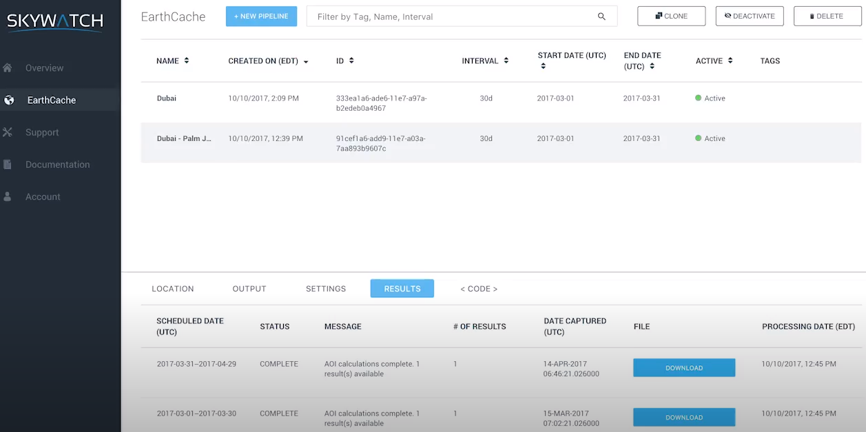


EarthCache - Prix
EarthCache est disponible en version gratuite et propose un essai gratuit.
Produits similaires à EarthCache
EarthCache - Avis
Évaluation des fonctionnalités
Tous les avis sur EarthCache
- Secteur d'activité : Compagnies aériennes/Aéronautique
- Taille de l'entreprise : 501–1 000 employés
- Logiciel utilisé tous les mois pendant 6 à 12 mois
-
Provenance de l'avis
The right soft to get satellite image
I use some satellite images to work on environmental issues and this soft has the perfect quality/price ratio.
Avantages
You can get a satellite image within a few minutes, with a ultra high quality and not too expensive.
Inconvénients
Customer service sometimes takes a long time to answer, but generally, they will solve any issue you have.
- Secteur d'activité : Vente au détail
- Taille de l'entreprise : 1 001–5 000 employés
- Logiciel utilisé toutes les semaines pendant plus d'un an
-
Provenance de l'avis
EarthCache is a powerful tool for GIS projects
It is a perfect soft to buy cheap and high quality images that you can use perfectly with any analysis software
Avantages
The quality of images are beyond my needs. The simple way to buy an image is perfect for people who need a high quantity of images to analize with projects all over my country. The prices are cheaper than other software or webpages that sell images too.
Inconvénients
Sometimes, the data of the image is not working with my QGIS software, or doesnt fit on it, but i think is a problem with the configuration of my program and not about the data of the image you buy.
- Secteur d'activité : Produits alimentaires
- Taille de l'entreprise : 11–50 employés
- Logiciel utilisé toutes les semaines pendant 6 à 12 mois
-
Provenance de l'avis
Good quality product, helpful support
Experiment on different forms of satellite imagery, take bite sized pieces without blowing the budget. Once have it right can easily consume the data.
Avantages
Makes it easy to consume satellite imagery in bite size pieces, test out new use cases and then set up automation once you have it right. The support team have been very responsive and helpful from day 1.
Inconvénients
Basemap could be satellite image so you can draw the area you want to monitor. When it's grey, means I have to create KMZ / KML in another tool, export and then import into the product.
Réponse de SkyWatch Space Applications
Thanks. We are happy you are enjoying EarthCache. In case you didn't know, you can toggle between a grey map and a satellite base map right within your dashboard. The toggle option is located in the top right corner of the map. Hopefully this helps.
